Held at the Caspian Sea Oceanographic Station (Nowshahr): ArcGIS software training workshop
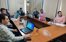
ArcGIS software application training workshop was held at the Caspian Sea Oceanographic Research and Technology Station (Nowshahr).
According to the public relations report of the research institute, in this 4-day training course, which was held on September 4, 1402, with the presence of colleagues of the research institute and interested parties, the ArcGIS software in spatial data analysis and map production, familiarization with satellite images, how to download and process them in ArcGIS, familiarization with creating vector images and working with them, ground reference and spatial adaptation, geostatistical analyzes and drawing zoning maps, familiarization with elevation models Digital and making 3D maps were taught.
Gographic Information System is one of the most powerful tools for decision-making, forecasting, management, analysis and modeling. Many parameters are involved in natural and artificial processes, so in order to check and manage them better, all these parameters should be taken into consideration. The existence of multiple layers of information in different sciences and the management of location-based data in an efficient and suitable system has made the need to learn ArcGIS software introductory for users of various disciplines.
It is worth mentioning that Dr. Mohammad Ali Hamzeh and Dr. Mehrshad Taheri were the scientific and executive secretary of this workshop.
 |  |