Water clarity values (sashi disc visibility) were modeled using satellite data
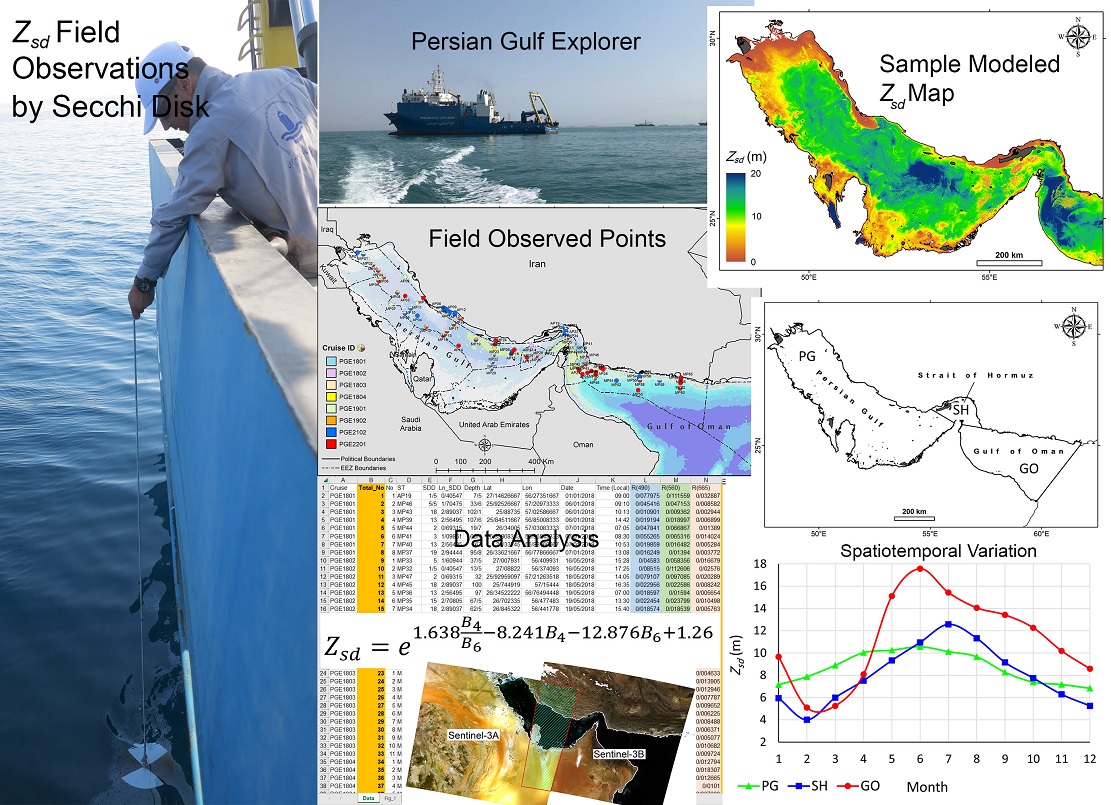
The values of water transparency (sashi disc visibility) were modeled using satellite data in the Persian Gulf and the Sea of Oman, by a member of the scientific staff of the National Research Institute of Oceanography and Atmospheric Sciences.
According to the research institute's public relations report, Dr. Keyvan Kabiri announced this news and said: Knowing and having information about the transparency of sea water is very vital to maintain the health of the marine environment. Therefore, for this purpose, a method to measure this parameter using satellite data Sentinel-3 (OLCI) It was modeled and developed for the southern seas of Iran (Persian Gulf, Strait of Hormuz and Oman Sea).
Regarding the reason for choosing this satellite data, he said: the reason for choosing this satellite data, besides being new, is free and free access to them. By analyzing these satellite data along with the field measurements carried out in the form of eight sea exploration patrols of the Persian Gulf in these seas, a native and optimized model for the southern seas of Iran in order to estimate water transparency values was developed.
The researcher of this article added: This model, which is based on the blue and green bands of this meter, gave more accurate and effective results than the existing global models, which finally provided an accurate formula for estimating values. The ability to view the sash disk (Secchi disc depth) which represents water transparency in these areas. The importance of this research is that changes in the transparency of sea water can provide a lot of information about the health of marine environments and the impact of various pollutions (both natural and human-caused). This research helps to monitor and understand these changes by using satellite data that cover wider areas and are much less expensive than traditional field measurements in the seas..
Based on the results of this research, the annual fluctuations of the values The ability to view the sash disk in the sea of Oman It ranges from 5 to 18 meters, which is significantly higher than these fluctuations in the Persian Gulf (4-12 meters) and the Strait of Hormuz. (7-10 meters).. Finally, it is worth mentioning that this research is the basis for using satellite data to monitor the water quality in these southern seas of Iran and helps to protect and manage these important marine environments. The results of this research in the form of an article ISI It has been published in "Environmental Sciences and Pollution Research" magazine.
https://link.springer.com/article/10.1007/s11356-023-27625-7
 |